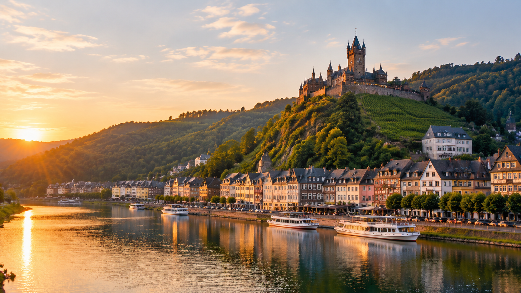
Cochem Imperial Castle
Perched on a hill above the town, this neo-Gothic castle dominates the local skyline. Look for its prominent spires as the river bends toward the town center.
View from the river deck before the boat docks in Cochem.
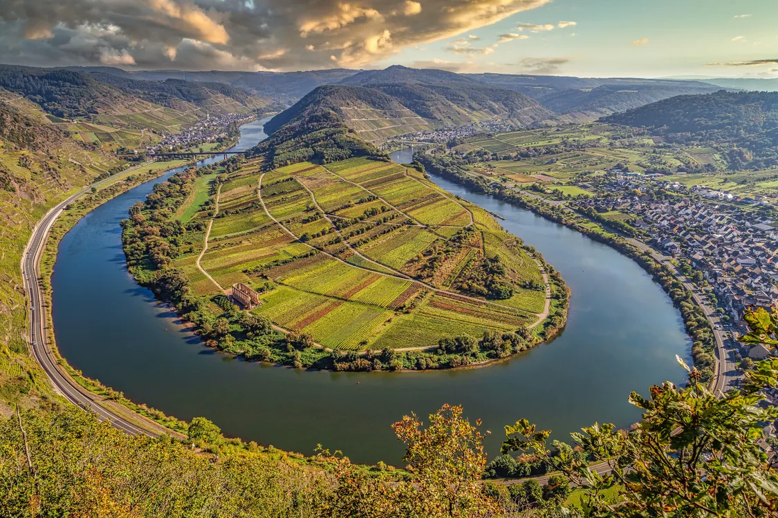
The Moselle winds through 195 kilometers of German valley between Trier and Koblenz, passing 28 villages and dozens of medieval castles. Understanding the river's layout helps you plan stops, identify landmarks from the deck, and choose which cruise segment matches your interests.
Quick answer
The Moselle River cruise corridor runs 195 kilometers from Trier to Koblenz through Germany, passing Bernkastel-Kues, Traben-Trarbach, Zell, and Cochem as the primary boarding points. Most cruise operators chart the river in three segments: Upper Moselle (Trier to Bernkastel, 50km), Middle Moselle (Bernkastel to Cochem, 70km), and Lower Moselle (Cochem to Koblenz, 75km), with the middle section holding the tightest bends and highest concentration of vineyards.
The Moselle executes 180-degree loops between Trittenheim and Piesport, bending back on itself so tightly that villages separated by 800 meters of hillside sit 14 river-kilometers apart. This geography defines the cruise experience. A moselle river cruise map reveals why certain segments take twice as long as their straight-line distance suggests, and why eastbound and westbound itineraries photograph entirely different castle profiles. The river drops only 55 meters across its German cruise length, creating a gentle current that passenger vessels navigate in both directions without locks between Trier and Koblenz. Three primary cruise segments divide the valley. The Upper Moselle between Trier and Bernkastel flows through wider agricultural land with Roman ruins marking the banks. The Middle Moselle from Bernkastel to Cochem compresses into the steepest vineyard slopes, where Riesling terraces climb 200 meters above the waterline and half-timbered wine villages occupy every inside bend. The Lower Moselle from Cochem to Koblenz opens again, trading vine density for castle ruins—Eltz, Pyrmont, Thurant—positioned on the ridgelines. Understanding this segmentation helps you match cruise duration to landscape priority. Most operators publish route charts marking kilometer posts, village docking points, and notable landmarks visible from the water. These navigation aids matter because the Moselle's tight meanders mean a castle that appears directly ahead may actually sit on the opposite bank, only becoming visible after a 20-minute bend. The river flows west to east through Germany, so morning light favors the north bank and afternoon sun illuminates the south-facing vineyards where premium wines grow. Cruise maps also indicate which villages offer direct train connections back to starting points, a practical consideration for one-way journeys. The German Moselle carries no commercial barge traffic, keeping the channel narrow and the cruising speed slower than Rhine voyages. This scale allows vessels to dock at village quays rather than industrial terminals, putting passengers within walking distance of wine estates and medieval town centers. The moselle river cruise map guide clarifies which stops permit disembarkation and which serve as scenic pass-throughs, a distinction that shapes itinerary value for travelers prioritizing exploration over observation.
“The Moselle bends back on itself so tightly between Trittenheim and Piesport that villages 800 meters apart by hillside sit 14 river-kilometers distant by water.”
This plan suits first-time visitors preparing a multi-day cruise itinerary along the Moselle River between Germany and France. Allow two to three days to cover the main segments at a relaxed pace.
Start with the Trier–Bernkastel-Kues stretch, typically 2–3 hours of sailing time. Note dock locations and transfer windows if switching vessels.
Examine Bernkastel-Kues to Cochem, the most scenic leg with castle viewpoints and vineyard terraces. Cruises here run 3–4 hours; confirm departure frequencies.
Trace Cochem to Koblenz, where the Moselle meets the Rhine. This final segment takes 2–3 hours and offers access to rail connections.
Cross-reference pier addresses with your accommodation in each town. Many operators require 30-minute pre-boarding; factor this into daily schedules.
Mark smaller stops like Traben-Trarbach or Zell if your cruise permits flexible boarding. These villages add 1–2 hours per detour but require advance confirmation with the operator.
The best arrival window is 09:00–11:00, as this period avoids mid-day crowds and provides favorable lighting for landscape photography. Planning your trip during spring or early autumn further enhances visibility and comfort.
Mild temperatures of 15°C to 22°C.
Vineyards are lush and daylight hours are long.
Cooler weather, 12°C to 19°C.
The wine harvest season offers scenic colors.
—
Arriving during this window ensures optimal light for photography and shorter wait times.
Verdict: For the best experience, plan your arrival between 09:00–11:00 on a weekday during the months of May, June, September, or October.
A Moselle River cruise offers views of steep vineyard slopes, historic castle ruins, and timber-framed villages. Mapping these landmarks helps travelers identify key points of interest along the winding river valley.
Perched on a hill above the town, this neo-Gothic castle dominates the local skyline. Look for its prominent spires as the river bends toward the town center.
View from the river deck before the boat docks in Cochem.
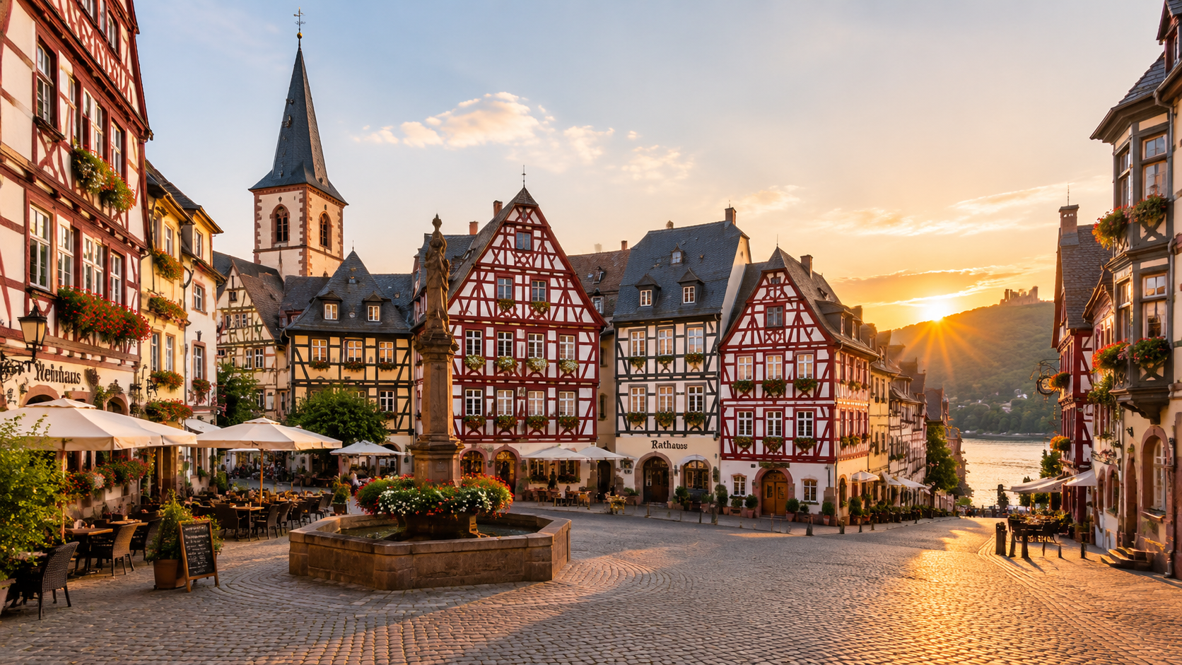
This town features a historic market square lined with well-preserved 17th-century half-timbered houses. The narrow streets offer a glimpse into medieval trade life along the river.
Observe the architecture from the top deck while passing the quay.
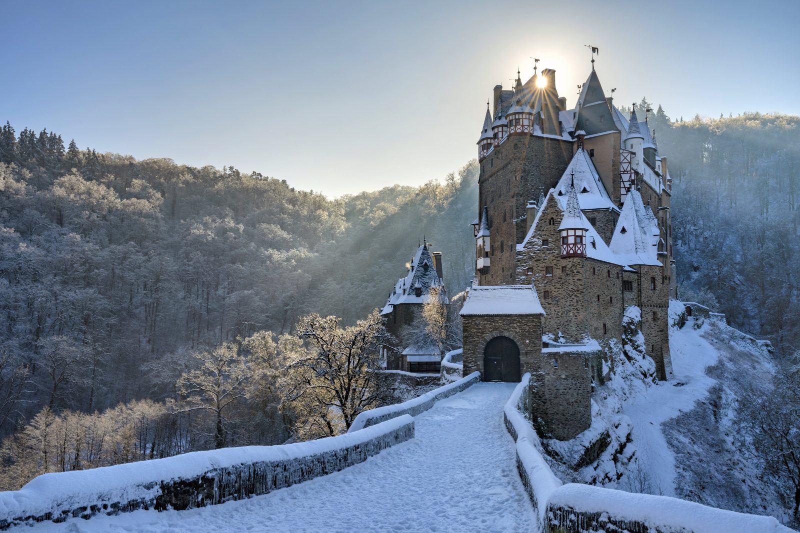
Though set back slightly in the forest valley, this 12th-century castle is visible from specific vantage points near Moselkern. It is widely considered a primary architectural landmark of the region.
Watch the western bank closely when approaching Moselkern.
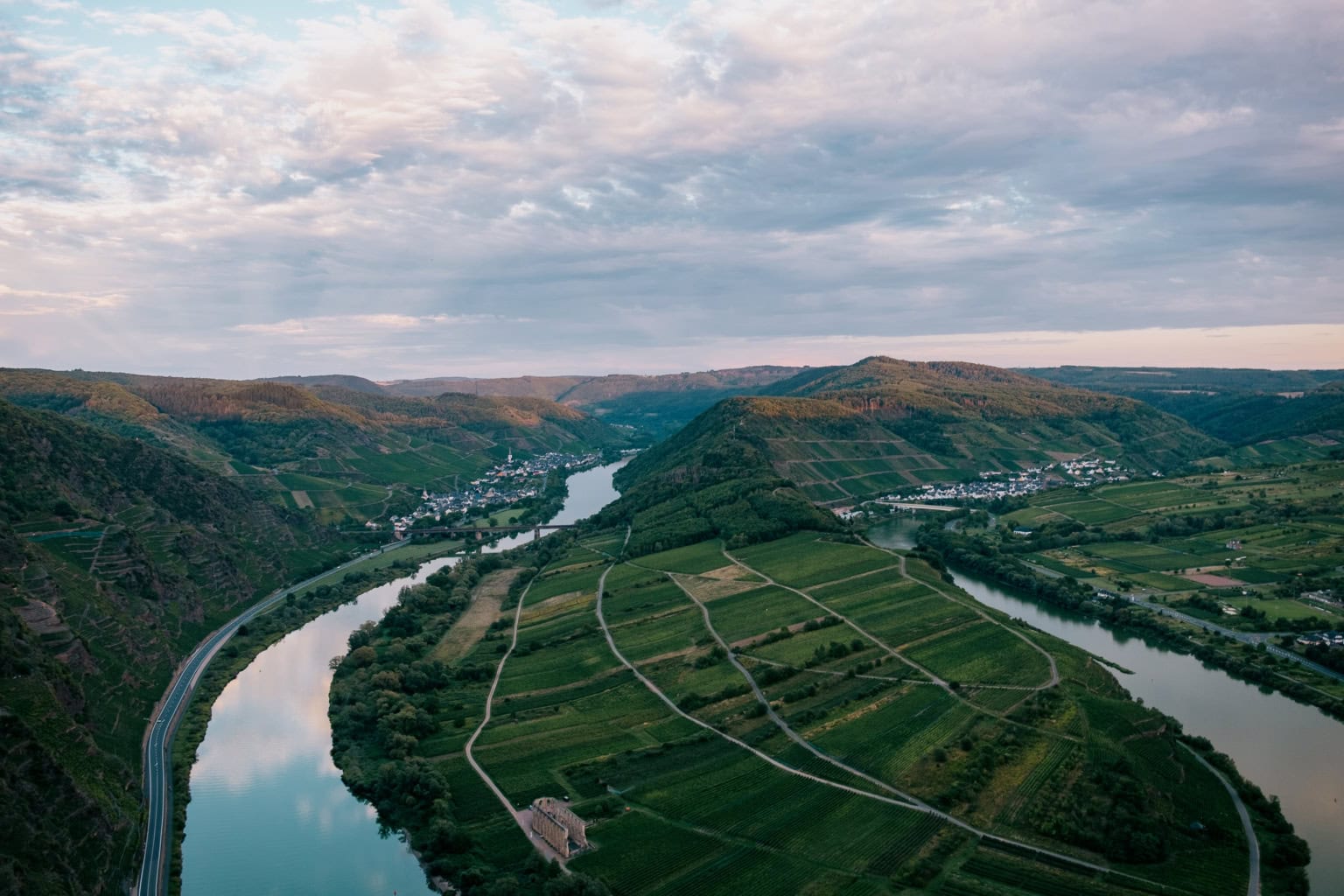
This is the steepest vineyard slope in Europe, rising sharply from the riverbanks. The terraced vines are visible for several kilometers along the route.
Use binoculars to spot the narrow hiking trail among vines.
The Moselle River flows through France and Germany, with major cruise departure points located in historic towns such as Koblenz, Cochem, and Trier. Regional rail networks provide the most reliable access to these riverfront docks.
RE1 or RE2 to Koblenz Hbf
Line 711 to Cochem Endertplatz
Walk from Trier Hbf to Moselle embankment
Plan your arrival for the 09:00–11:00 window to avoid mid-day crowds and ensure optimal conditions for river landscape photography.
There is no entrance fee for the Moselle River itself. Cruise costs depend entirely on the specific trip segment, operator, and duration selected.
Verdict: A typical adult pays a variable rate determined by the specific cruise operator and the length of the chosen river journey.
The facilities along the Moselle River maintain consistent operating hours throughout the week to assist with cruise planning.
Everything you need to know about moselle river cruise map
A reliable moselle river cruise map highlights key locks, scenic vineyard slopes, and major docking points. It serves as your primary tool for navigating the various charming towns along the waterway. Using this navigational aid helps you identify where your vessel will pause for sightseeing.
Official boat tour guides often provide a detailed Moselle river itinerary that outlines the stops between Trier and Koblenz. These maps indicate specific points of interest, such as historic castles and medieval fortifications. You can use these visual guides to track your progress through the meanders of the valley.
To plan your day, use the moselle river cruise map to identify which villages offer the most appealing shore excursions. Match your interests with the boat schedule to ensure you have enough time to explore local wine cellars or ruins. Consulting the map early allows for a more structured and enjoyable travel experience.
There is 0 EUR entrance fee for the river itself, as it is a public waterway. Cruise tickets are purchased per individual trip rather than for general access. You can book your specific voyage through the available options on our site.
The best arrival window is 09:00–11:00 to avoid mid-day crowds and capture optimal lighting for landscape photography. Planning your arrival during these hours allows for a relaxed start before the busiest period of the day. This timing is especially beneficial for those wanting to photograph the river banks without obstruction.
While no map can show every detail, a comprehensive moselle river cruise map will feature major cultural landmarks and UNESCO sites. Focus on the icons representing hilltop castles and historic bridges to ensure you do not miss the valley's highlights. These visual markers are essential for understanding the geography of your journey.
Cruising the Moselle is an excellent option for families who want to enjoy the scenery from the water. Many vessels offer kid-friendly amenities and ample space to move around while viewing the passing landscape. Ensure you check the specific cruise provider's offerings for child-focused activities or facilities.